Daily life before averages
A neighbourhood is understood through travel, the services a household actually uses, public spaces, and the pace it wants.
Neighbourhood portrait
A mostly residential riverside area shaped by parks and open spaces.
Estimate my home →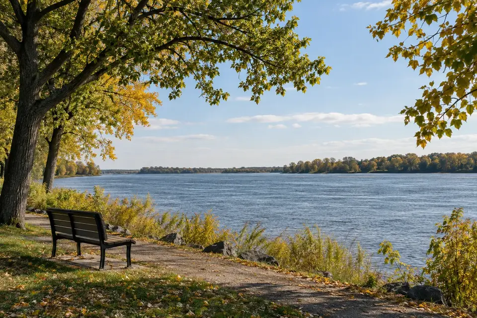
Understand the area
Rivière-des-Prairies has a residential identity tied to the river, parks, and open spaces. Evaluating an address requires separating the broad area portrait from the street, daily travel patterns, and the physical characteristics of the lot and building.
Three ways to read the context
A neighbourhood is understood through travel, the services a household actually uses, public spaces, and the pace it wants.
Two properties in the same area can offer very different contexts. The street, block, and immediate surroundings matter.
Maps and portraits guide the search. A decision then requires checking the property, documents, and applicable rules.
Household and dwelling profile
Figures use the Rivière-des-Prairies row in the municipal profile; they exclude Marc-Aurèle-Fortin and Pointe-aux-Trembles.
+3.7 % from 2016 to 2021
Share of owner households in 2021.
Before-tax income reported in the profile.
Median shelter cost: $1,230 per month.
Housing forms
These shares describe occupied dwellings; they are neither a sales distribution nor a price measure.
Ville de Montréal, 2021 Household and Dwelling Profiles, using Statistics Canada 2021 Census data.
Verified reference points
Every figure identifies its period, geography, and source. Changing market data stays on the Market page so the neighbourhood portrait is not confused with property-market trends.
Rivière-des-Prairies sector using Montréal housing-reference areas.
Combined-borough total, not RDP alone.
Large natural area spanning river, woodland, and St. Lawrence sectors.
Seasonal service that should be checked before each trip.
See and experience
In the heart of Old Rivière-des-Prairies, this riverside park offers universally accessible features, splash pads, and gathering spaces.
View the official listing ↗A large area for hiking, cycling, cross-country skiing, and wildlife observation, with several sectors accessible from the east end.
View the official listing ↗The historic corridor follows the river and connects older homes, parks, lookouts, and cycling segments. Conditions vary by section.
View the official listing ↗A seasonal project at parc Saint-Joseph supports local shopping and activity in the old village centre. Dates change each year.
View the official listing ↗Daily life
A neighbourhood is experienced street by street. These points help prepare a visit and verify what matters to your household.
Internal distances can be substantial. A service appearing nearby on a borough map may not be easily accessible from every address.
Bus, car, bicycle, and commuter rail can play different roles depending on the destination. Test an actual trip at the hours when you will need it.
The river shapes the neighbourhood, but public access, views, and uses vary. A property described as “near the water” should be checked against actual streets and parks.
River and natural settings require checking constraint zones, planning rules, and insurance considerations for the address.
Housing
The area includes detached homes, plexes, condominiums, and rental buildings. Older areas near boulevard Gouin differ from newer developments.
Lot size, drainage, foundations, renovations, and accessory structures may strongly affect comparisons between two homes.
A sale across the borough may reflect different access, construction periods, and surroundings. Comparable properties should stay close in type and context.
Through the year
Dates, locations, and conditions change. Always check official programming before visiting.
Summer programming brings performances, art, outdoor recreation, and free activities to several RDP–PAT locations.
Market dates at parc Saint-Joseph animate the old village centre. Check the current year’s program.
Kayaking, fishing, cycling, hiking, and guided activities are available seasonally depending on location and conditions.
Sledding, snowshoeing, and cross-country skiing add a four-season dimension, especially in the nature park.
Frequently asked questions
No. They share a borough, but RDP is organized around the Rivière des Prairies while PAT has a more direct relationship with the St. Lawrence and its old village.
The area has riverside parks and strong access to the nature park. Check actual distance from the address and which activities are available each season.
Test trips to work, school, and services at normal travel times. Results may vary more than a distance in kilometres suggests.
The Rivière-des-Prairies Market page gathers approved available data. Annual change is published only when an authorized transaction source properly covers the area.
Published data
Displayed data has passed source, period, geography, and quality controls. Missing data remains unavailable instead of being estimated or replaced with zero.
Housing-unit count published by the Ville de Montréal for the housing-reference areas composing the geography.
Sources and method
Method: missing or stale data is shown as unavailable and is never replaced with zero.
Home IQ
Connect the broad portrait with the actual context of the property you are considering.